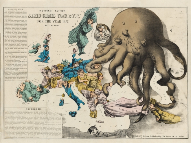
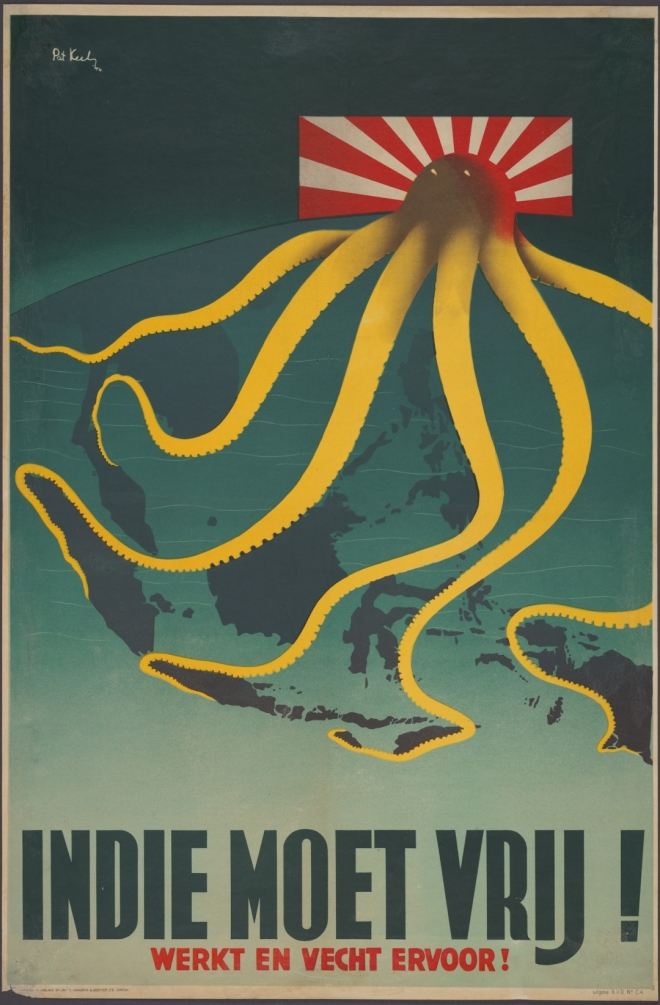
Hyperallergic has assembled a great collection of 19th century maps employing the caricatures of octopus as a motif to represent perceived threat from omni-directional, spreading “tentacles of power” of an alien, in-human, or otherwise denatured global economic or military power. Frank Jacobs expands on this, outlining the “Cartographic Land Octopus” as a particularly insidious trope of cartographic space, drawing on fears for Kraken-like creatures from the deep, “its ugly head is the centre of a malevolent intelligence, which is manipulating its obscene appendages to bring death and destruction to its surroundings.” Many of these maps are drawn from the excellent PJ Mode Collection at Cornell that focuses on “Persuasive Cartography” from the 15th century onward.